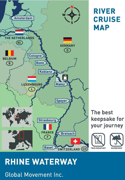
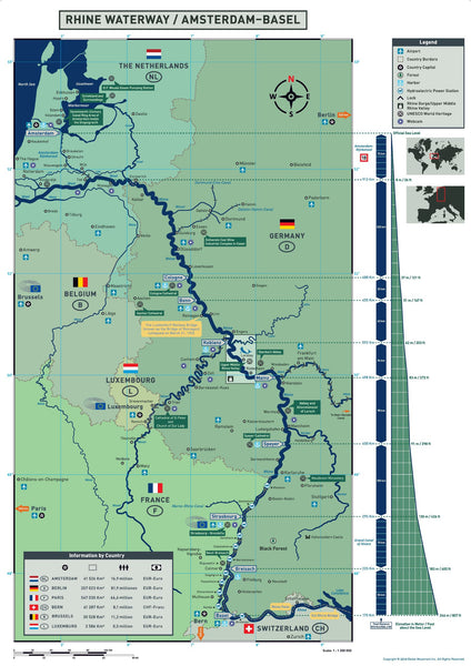
Rhine Waterway (Amsterdam - Basel)
The map presents the Rhine River waterway between Amsterdam-Basel and provides useful and interesting information.
The Rhine is one of Europe's most important rivers. It rises high up in the Swiss Alps from two smaller streams, the Vorderrhein and the Hinterrhein, which merge in Reichenau, Switzerland. Then it turns north (a rather unusual flow pattern) and crosses the border of Switzerland and Lichtenstein, then the border of Switzerland and Austria, where it flows westwards over the foresea arm into Lake Constance. Here the river flowsnorthwards and continues its way through France and Germany to the Netherlands. In the Netherlands, the Rhine turns west again. The Rhine changes its name more often as it flowsthrough the RhineDelta. Itflows past the third largest port inthe world, Rotterdam (kilometer mark 1000) and flows into the North Sea at Hoek van Holland (kilometre mark 1036).
The Rhine is measured in kilometres, starting in Constance, in Switzerland (kilometre mark 0). It is passable from Rheinfelden (kilometre mark 150) and ends in Hoek van Holland (kilometre mark 1036). Mileage markers on the banks of the river show at which point of the Rhine you are currently located. The total length of the Rhine is 1232 kilometers.
The Amsterdam-Rhine Canal
(Amsterdam-Rijnkannal)
This canal is the busiest canal in Western Europe. It was opened in May 1952 and expanded in the 1970s. The Amsterdam-Rhine Canal connects the IJ River in Amsterdam in a southwesterly direction past Wijk bij Duurstede, further on to the Waal River at Tiel.
The canal is 72 kilometres long, with an average depth of 5.5 metres.
The Moselle
The French call the river Moselle, the Germans call it the Moselle. No matter what you call it, this river is a very important tributary of the Rhine. This 546 km long river rises high in the slopes of the Vosges Mountains in France.
The Moselle flows for 317 kilometres to the north, then further north-east, where it leaves France and forms the short border of 36 kilometres between Luxembourg and Germany. Afterwards, the river flows, over 193 kilometers, all through Germany, through the Moselle valley, which is a popular wine region. Afterwards, the Moselle meets the Rhine in the town of Koblenz at Deutsche Eck (German Corner)
This valuable tool will enhance your river cruise experience and serve as a reminder of the wonderful journey that is found only on European rivers.
- Specially designed for river cruise passengers and travel agents
- Durable and user friendly
- Compact with accurate information
- Water proof and tear resistant
- Map Size: open: 16.5" x 23.4" (420 mm x 594 mm) folded: 4.1" x 5.8" (105 x 148 mm)
NOTE: To order in Europe, please email us : globalrivermaps@gmail.com